Weather Warnings UK

Warning UK Day 0

Warning UK Day 1

Warning UK Day 2

Warning UK Day 3

Warning UK Day 4

Warning UK Day 0
00:00-06:00

Warning UK Day 0
06:00-12:00

Warning UK Day 0
12:00-18:00

Warning UK Day 0
18:00-24:00


Be aware
 
Be prepared
 
Take action
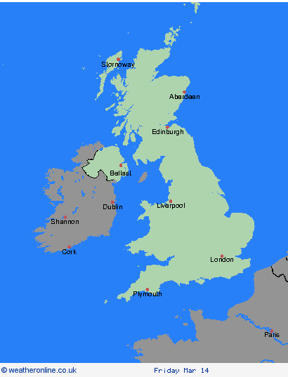
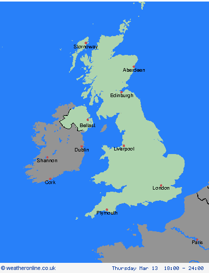
Coloured regions on the map show where severe weather warnings have been issued.
Warning wind
Wind
Warning rain
Rain
Warning snow
Snow
Warning ice
Ice
Warning fog
Fog
Weather Warnings, 06.05.2024, UK

Severe Weather Warnings: Thunderstorms

Date

issued by the Metoffice at
   20:00, 06.05.2024

valid from
   13:00, 06.05.2024
until
   21:00, 06.05.2024


Region: Strathclyde

Warning

Thunderstorms and heavy downpours are likely to break out in some places this afternoon and evening. Although not all places will catch these storms and downpours, where they do occur 20 to 40 mm rain may fall in some places in an hour or two. What should I do? Consider if your location is at risk of flash flooding. If so, consider preparing a flood plan and an emergency flood kit. Give yourself the best chance of avoiding delays by checking road conditions if driving, or bus and train timetables, amending your travel plans if necessary. People cope better with power cuts when they have prepared for them in advance. It’s easy to do; consider gathering torches and batteries, a mobile phone power pack and other essential items. If you find yourself outside and hear thunder, protect yourself by finding a safe enclosed shelter (such as a car). Do not shelter under or near trees, or other structures which may be struck by lightning. If you are on an elevated area move to lower ground. Be prepared for weather warnings to change quickly: when a weather warning is issued, the Met Office recommends staying up to date with the weather forecast in your area.

Chief Forecaster

Thunderstorms and heavy downpours may cause flooding and travel disruption.

The public is advised to take extra care, further information and advice can be found here: http://www.metoffice.gov.uk/weather/uk/links.html

Local Authorities: Argyll and Bute, East Ayrshire, East Dunbartonshire, East Renfrewshire, Glasgow, Inverclyde, North Ayrshire, North Lanarkshire, Renfrewshire, South Ayrshire, South Lanarkshire, West Dunbartonshire

Severe Weather Warnings: Thunderstorms

Date

issued by the Metoffice at
   20:00, 06.05.2024

valid from
   13:00, 06.05.2024
until
   21:00, 06.05.2024


Region: Central, Tayside & Fife

Warning

Thunderstorms and heavy downpours are likely to break out in some places this afternoon and evening. Although not all places will catch these storms and downpours, where they do occur 20 to 40 mm rain may fall in some places in an hour or two. What should I do? Consider if your location is at risk of flash flooding. If so, consider preparing a flood plan and an emergency flood kit. Give yourself the best chance of avoiding delays by checking road conditions if driving, or bus and train timetables, amending your travel plans if necessary. People cope better with power cuts when they have prepared for them in advance. It’s easy to do; consider gathering torches and batteries, a mobile phone power pack and other essential items. If you find yourself outside and hear thunder, protect yourself by finding a safe enclosed shelter (such as a car). Do not shelter under or near trees, or other structures which may be struck by lightning. If you are on an elevated area move to lower ground. Be prepared for weather warnings to change quickly: when a weather warning is issued, the Met Office recommends staying up to date with the weather forecast in your area.

Chief Forecaster

Thunderstorms and heavy downpours may cause flooding and travel disruption.

The public is advised to take extra care, further information and advice can be found here: http://www.metoffice.gov.uk/weather/uk/links.html

Local Authorities: Clackmannanshire, Falkirk, Perth and Kinross, Stirling

Severe Weather Warnings: Thunderstorms

Date

issued by the Metoffice at
   20:00, 06.05.2024

valid from
   13:00, 06.05.2024
until
   21:00, 06.05.2024


Region: SW Scotland, Lothian Borders

Warning

Thunderstorms and heavy downpours are likely to break out in some places this afternoon and evening. Although not all places will catch these storms and downpours, where they do occur 20 to 40 mm rain may fall in some places in an hour or two. What should I do? Consider if your location is at risk of flash flooding. If so, consider preparing a flood plan and an emergency flood kit. Give yourself the best chance of avoiding delays by checking road conditions if driving, or bus and train timetables, amending your travel plans if necessary. People cope better with power cuts when they have prepared for them in advance. It’s easy to do; consider gathering torches and batteries, a mobile phone power pack and other essential items. If you find yourself outside and hear thunder, protect yourself by finding a safe enclosed shelter (such as a car). Do not shelter under or near trees, or other structures which may be struck by lightning. If you are on an elevated area move to lower ground. Be prepared for weather warnings to change quickly: when a weather warning is issued, the Met Office recommends staying up to date with the weather forecast in your area.

Chief Forecaster

Thunderstorms and heavy downpours may cause flooding and travel disruption.

The public is advised to take extra care, further information and advice can be found here: http://www.metoffice.gov.uk/weather/uk/links.html

Local Authorities: Dumfries and Galloway, Scottish Borders, West Lothian

Severe Weather Warnings: Thunderstorms

Date

issued by the Metoffice at
   20:00, 06.05.2024

valid from
   13:00, 06.05.2024
until
   21:00, 06.05.2024


Region: Wales

Warning

Thunderstorms and heavy downpours are likely to break out in some places this afternoon and evening. Although not all places will catch these storms and downpours, where they do occur 20 to 40 mm rain may fall in some places in an hour or two. What should I do? Consider if your location is at risk of flash flooding. If so, consider preparing a flood plan and an emergency flood kit. Give yourself the best chance of avoiding delays by checking road conditions if driving, or bus and train timetables, amending your travel plans if necessary. People cope better with power cuts when they have prepared for them in advance. It’s easy to do; consider gathering torches and batteries, a mobile phone power pack and other essential items. If you find yourself outside and hear thunder, protect yourself by finding a safe enclosed shelter (such as a car). Do not shelter under or near trees, or other structures which may be struck by lightning. If you are on an elevated area move to lower ground. Be prepared for weather warnings to change quickly: when a weather warning is issued, the Met Office recommends staying up to date with the weather forecast in your area.

Chief Forecaster

Thunderstorms and heavy downpours may cause flooding and travel disruption.

The public is advised to take extra care, further information and advice can be found here: http://www.metoffice.gov.uk/weather/uk/links.html

Local Authorities: Conwy, Denbighshire, Flintshire, Gwynedd, Powys, Wrexham

Severe Weather Warnings: Thunderstorms

Date

issued by the Metoffice at
   20:00, 06.05.2024

valid from
   13:00, 06.05.2024
until
   21:00, 06.05.2024


Region: North West England

Warning

Thunderstorms and heavy downpours are likely to break out in some places this afternoon and evening. Although not all places will catch these storms and downpours, where they do occur 20 to 40 mm rain may fall in some places in an hour or two. What should I do? Consider if your location is at risk of flash flooding. If so, consider preparing a flood plan and an emergency flood kit. Give yourself the best chance of avoiding delays by checking road conditions if driving, or bus and train timetables, amending your travel plans if necessary. People cope better with power cuts when they have prepared for them in advance. It’s easy to do; consider gathering torches and batteries, a mobile phone power pack and other essential items. If you find yourself outside and hear thunder, protect yourself by finding a safe enclosed shelter (such as a car). Do not shelter under or near trees, or other structures which may be struck by lightning. If you are on an elevated area move to lower ground. Be prepared for weather warnings to change quickly: when a weather warning is issued, the Met Office recommends staying up to date with the weather forecast in your area.

Chief Forecaster

Thunderstorms and heavy downpours may cause flooding and travel disruption.

The public is advised to take extra care, further information and advice can be found here: http://www.metoffice.gov.uk/weather/uk/links.html

Local Authorities: Blackburn with Darwen, Cheshire East, Cheshire West and Chester, Cumbria, Greater Manchester, Halton, Lancashire, Merseyside, Warrington

Severe Weather Warnings: Thunderstorms

Date

issued by the Metoffice at
   20:00, 06.05.2024

valid from
   13:00, 06.05.2024
until
   21:00, 06.05.2024


Region: North East England

Warning

Thunderstorms and heavy downpours are likely to break out in some places this afternoon and evening. Although not all places will catch these storms and downpours, where they do occur 20 to 40 mm rain may fall in some places in an hour or two. What should I do? Consider if your location is at risk of flash flooding. If so, consider preparing a flood plan and an emergency flood kit. Give yourself the best chance of avoiding delays by checking road conditions if driving, or bus and train timetables, amending your travel plans if necessary. People cope better with power cuts when they have prepared for them in advance. It’s easy to do; consider gathering torches and batteries, a mobile phone power pack and other essential items. If you find yourself outside and hear thunder, protect yourself by finding a safe enclosed shelter (such as a car). Do not shelter under or near trees, or other structures which may be struck by lightning. If you are on an elevated area move to lower ground. Be prepared for weather warnings to change quickly: when a weather warning is issued, the Met Office recommends staying up to date with the weather forecast in your area.

Chief Forecaster

Thunderstorms and heavy downpours may cause flooding and travel disruption.

The public is advised to take extra care, further information and advice can be found here: http://www.metoffice.gov.uk/weather/uk/links.html

Local Authorities: Darlington, Durham, Gateshead, Hartlepool, Middlesbrough, Newcastle upon Tyne, North Tyneside, Northumberland, Redcar and Cleveland, South Tyneside, Stockton-on-Tees, Sunderland

Severe Weather Warnings: Thunderstorms

Date

issued by the Metoffice at
   20:00, 06.05.2024

valid from
   13:00, 06.05.2024
until
   21:00, 06.05.2024


Region: Yorkshire & Humber

Warning

Thunderstorms and heavy downpours are likely to break out in some places this afternoon and evening. Although not all places will catch these storms and downpours, where they do occur 20 to 40 mm rain may fall in some places in an hour or two. What should I do? Consider if your location is at risk of flash flooding. If so, consider preparing a flood plan and an emergency flood kit. Give yourself the best chance of avoiding delays by checking road conditions if driving, or bus and train timetables, amending your travel plans if necessary. People cope better with power cuts when they have prepared for them in advance. It’s easy to do; consider gathering torches and batteries, a mobile phone power pack and other essential items. If you find yourself outside and hear thunder, protect yourself by finding a safe enclosed shelter (such as a car). Do not shelter under or near trees, or other structures which may be struck by lightning. If you are on an elevated area move to lower ground. Be prepared for weather warnings to change quickly: when a weather warning is issued, the Met Office recommends staying up to date with the weather forecast in your area.

Chief Forecaster

Thunderstorms and heavy downpours may cause flooding and travel disruption.

The public is advised to take extra care, further information and advice can be found here: http://www.metoffice.gov.uk/weather/uk/links.html

Local Authorities: East Riding of Yorkshire, North Yorkshire, South Yorkshire, West Yorkshire, York

Severe Weather Warnings: Thunderstorms

Date

issued by the Metoffice at
   20:00, 06.05.2024

valid from
   13:00, 06.05.2024
until
   21:00, 06.05.2024


Region: West Midlands

Warning

Thunderstorms and heavy downpours are likely to break out in some places this afternoon and evening. Although not all places will catch these storms and downpours, where they do occur 20 to 40 mm rain may fall in some places in an hour or two. What should I do? Consider if your location is at risk of flash flooding. If so, consider preparing a flood plan and an emergency flood kit. Give yourself the best chance of avoiding delays by checking road conditions if driving, or bus and train timetables, amending your travel plans if necessary. People cope better with power cuts when they have prepared for them in advance. It’s easy to do; consider gathering torches and batteries, a mobile phone power pack and other essential items. If you find yourself outside and hear thunder, protect yourself by finding a safe enclosed shelter (such as a car). Do not shelter under or near trees, or other structures which may be struck by lightning. If you are on an elevated area move to lower ground. Be prepared for weather warnings to change quickly: when a weather warning is issued, the Met Office recommends staying up to date with the weather forecast in your area.

Chief Forecaster

Thunderstorms and heavy downpours may cause flooding and travel disruption.

The public is advised to take extra care, further information and advice can be found here: http://www.metoffice.gov.uk/weather/uk/links.html

Local Authorities: Shropshire, Staffordshire, Stoke-on-Trent

Severe Weather Warnings: Thunderstorms

Date

issued by the Metoffice at
   20:00, 06.05.2024

valid from
   13:00, 06.05.2024
until
   21:00, 06.05.2024


Region: East Midlands

Warning

Thunderstorms and heavy downpours are likely to break out in some places this afternoon and evening. Although not all places will catch these storms and downpours, where they do occur 20 to 40 mm rain may fall in some places in an hour or two. What should I do? Consider if your location is at risk of flash flooding. If so, consider preparing a flood plan and an emergency flood kit. Give yourself the best chance of avoiding delays by checking road conditions if driving, or bus and train timetables, amending your travel plans if necessary. People cope better with power cuts when they have prepared for them in advance. It’s easy to do; consider gathering torches and batteries, a mobile phone power pack and other essential items. If you find yourself outside and hear thunder, protect yourself by finding a safe enclosed shelter (such as a car). Do not shelter under or near trees, or other structures which may be struck by lightning. If you are on an elevated area move to lower ground. Be prepared for weather warnings to change quickly: when a weather warning is issued, the Met Office recommends staying up to date with the weather forecast in your area.

Chief Forecaster

Thunderstorms and heavy downpours may cause flooding and travel disruption.

The public is advised to take extra care, further information and advice can be found here: http://www.metoffice.gov.uk/weather/uk/links.html

Local Authorities: Derbyshire, Nottinghamshire

Severe Weather Warnings: Cancelled

Date

issued by the Metoffice at
   20:00, 06.05.2024

valid from
   12:00, 06.05.2024
until
   21:00, 06.05.2024


Region: South West England

Cancelled
Local Authorities: Bournemouth Christchurch and Poole, Dorset

Severe Weather Warnings: Cancelled

Date

issued by the Metoffice at
   20:00, 06.05.2024

valid from
   12:00, 06.05.2024
until
   21:00, 06.05.2024


Region: London & South East England

Cancelled
Local Authorities: Brighton and Hove, East Sussex, Greater London, Hampshire, Isle of Wight, Kent, Medway, Portsmouth, Southampton, Surrey, West Sussex